May 8, 2017 9 a.m.
Creek levels are going down which has allowed the Emergency Operation Centre to rescind the following previously issued Evacuation Orders for properties within the City of Kelowna.
184 Adams Road
214 Adams Road
222 Adams Road
1980 Ethel Street
543 Rowcliffe Avenue
3911 Old Vernon Road
Residents and property owners that are no longer under Evacuation Order and are now able to access their property should be aware that they may not have full services. There are many conditions that must be considered including whether there has been flood/water damage and the status of utilities and electrical/gas service. Those with property managers should see them to obtain information on the safety and status of their property.
Late last night, an Evacuation Order was expanded for the following 20 properties within Holiday Park Resort, 415 Commonwealth Road:
odd number addresses from 439 to 461 Rest Route
odd number addresses from 403 to 417 Water Way
And an Evacuation Order was issued for the following five units at 720 Commonwealth Road:
233, 234, 235, 236 and the unit opposite 233
Disaster Financial Assistance is now available to eligible B.C. residents impacted by the damaging flooding that began on Friday.
May 8, 2017 6 a.m.
Flooding troubles continue to plague Central Okanagan residents as the new week gets underway.
Although some Kelowna residents dealing with flooding on Mill Creek have benefitted from receding water—turning their efforts now to restoration— the Central Okanagan Regional District sent out an expanded evacuation order after midnight on Sunday and the earlier warning that more flooding around the valley is expected with warmer temperatures stands.
The latest Evacuation Order has been expanded to include the following properties on Rest Route and Water Way within Holiday Park RV and Condo Resort at 415 Commonwealth Road due to flooding:
439 Rest Route
441 Rest Route
443 Rest Route
445 Rest Route
447 Rest Route
449 Rest Route
451 Rest Route
453 Rest Route
455 Rest Route
457 Rest Route
459 Rest Route
461 Rest Route
403 Water Way
405 Water Way
407 Water Way
409 Water Way
411 Water Way
413 Water Way
415 Water Way
417 Water Way
And a new Evacuation Order has been issued for the following units at 720 Commonweath Road:
233, 234, 235, 236 and the unit opposite 233
These affected residents are encouraged to register with the Emergency Support Services volunteers staffing the reception centre at the Salvation Army Church, 1480 Sutherland Avenue (corner of Sutherland Avenue and Burtch Road). It has reopened to assist these new evacuees and will then close. It will open again at 11 a.m. tomorrow (Monday) morning.
Details and specific addresses can be viewed on the Regional Emergency Program website map www.cordemergency.ca/map.The map also shows locations of sand and sandbags along with road closures due to flooding.
Assessments continue on all properties under Evacuation Orders with the goal of returning those properties to their owners as soon as possible.
Emergency Management BC has new information available for residents to consider when returning to their home after flooding. Some areas of importance include the safety of drinking water, safety regarding electrical and gas utilities, food safety and caution surrounding removal of furniture and building materials https://news.gov.bc.ca/releases/2017TRAN0174-001191
The Emergency Operation Centre recommends all sandbags be left in place even if it appears that stream and water levels are dropping. Conditions and weather can change without notice resulting in a return to high water levels and potential flooding.
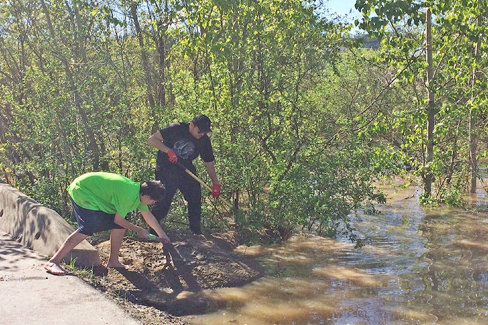
Officials continue to monitor the levels and flows of area creeks, streams and lakes. Residents should use extreme caution and keep children and pets away from creek banks which can be very slippery and subject to erosion. Water levels and flows may rise unexpectedly. Boaters are asked to keep speeds down when near the shoreline to reduce potential wake erosion. As well, they should watch for floating debris flowing into area lakes due to the higher flows.
Travel is not recommended on Chute Lake Road due to washouts and deteriorating conditions.
The following previously issued Evacuation Orders and Alerts continue to be in effect:
Okanagan Indian Band IR#7
Order - 415 Commonwealth Road, Holiday Park– Beachview building
Order - 415 Commonwealth Road, Holiday Park – Park Place building
Order - 7841 Highway 97 – Turtle Lodges
City of Kelowna (Orders)
1966 Richter St
222 Adams Rd
184 Adams Rd
214 Adams Rd
3911 Old Vernon Rd
3545 Bulman Rd
1826 Marshall Rd
3897 Casorso Rd
4697 Gordon Dr
1980 Ethel St
1981 Gordon Dr
1824 Marshall Rd
1237 Pacific Ave
2002 Ethel St
543 Rowcliffe Avenue
534 Sutherland Avenue
1955 Pacific Court
1915 Pacific Court
1902 Lindahl Street
1936 Lindahl Street
1948 Lindahl Street
1118 Brookside Avenue
1122 Brookside Avenue
1130 Brookside Avenue
Regional District of the Central Okanagan
An Evacuation Order for Fintry Provincial Park remains in effect
An Evacuation Alert remains in effect for approximately 90 properties inthe Fintry Delta area, just south of Fintry Provincial Park. Properties that are affected by the Alert include those in the delta accessed by Fintry Delta Road, Morden Road and Shorts Road.
Residents on alert should be prepared to leave their homes on short notice should conditions along Shorts Creek worsen. They may also wish to take steps to protect their properties from potential flooding.
Declarations of Local States of Emergency remain for the City of Kelowna, the City of West Kelowna and for the Fintry Delta in the Regional District of Central Okanagan to address flooding.
Information on Flood Preparedness and Returning After A Flood
The Preparedness BC website has information to help those property owners with protecting their property from flooding and some considerations for those returning after a flood. http://www2.gov.bc.ca/assets/gov/public-safety-and-emergency-services/emergency-preparedness-response-recovery/embc/preparedbc/preparedbc_flood_information_for_homeowners_and_home_buyers_web.pdf
Interior Health also has information available for residents to consider Before, During and After a flood: https://www.interiorhealth.ca/YourEnvironment/EmergencyPreparedness/Pages/Flooding.aspx
Information on flooding and electrical safety is also available for BC Hydro and FortisBC customers: www.bchydro.com www.fortisbc.com
The Boil Water Advisory for Westbank First Nation IR#9 continues. More information and a water system map are available at www.wfn.ca/wfnnews.htm.
For up to date information on the situation including a map and to sign up for e-updates, visit www.cordemergency.ca.
Anyone noticing a potential problem or a flooding concern is asked to call the Kelowna Fire Department at 250-469-8801.
Information will also be provided via the https://twitter.com/CO_Emerg and https://www.facebook.com/CORDEmergency/. For more information contact the Information Office at 250-469-8490 or 1-877-569-8490 (toll-free).