A unique project is underway that will result in a more colourful way to promote Kelowna and the surrounding area.
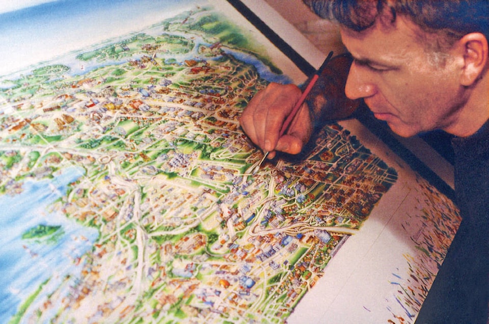
Montreal artist Jean-Louis Rheault is currently in the process of creating a new version of the widely popular Kelowna Geopictorial map, originally created by Rheault in 2012.
The original map, a visually striking cartographic portrait of the community, was originally showcased as art prints in local businesses and large panels at local visitor centres.
The new art is scheduled to be completed in July and will be made available free to the public for the very first time, according to Mountain Media.
The new map will be available in a foldout travel guide, which will promote the Kelowna area as an increasingly world-class tourist destination.
It will feature information about businesses and attractions in the area and will be available through an extensive free annual distribution to visitors and locals alike. Rheault’s original 2012 Kelowna Geopictorial map has received recognition worldwide, said Mountain Media.
In 2014, it was published in the North American Cartographic Information Society’s Atlas of Design, which honoured the work as an example of some of the world’s best cartography. In 2015, the map was published in The Art of Illustrated Maps.
For more than four decades, Rheault has produced map illustrations around the world. His extensive portfolio features famous destinations such as The Grand Canyon, Singapore, Montreal, Santa Fe, Alaska and Dubai, said Mountain Media.
“If a picture is worth a thousand words, a good pictorial map is worth a thousand pictures,” Rheault said.
Samples of Rheault’s work can be viewed at JLRmaps.com.
To report a typo, email: edit@kelownacapnews.com.
@KelownaCapNews
newstips@kelownacapnews.com
Like us on Facebook and follow us on Twitter.