From record flooding to disastrous wildfires, 2017 will go down as one of B.C’s most catastrophic years ever for extreme weather.
Kelowna was first awash with water-woes May 4 when a storm dropped so much rain that Mill Creek broke its banks and flooded homes and businesses that lined the waterway.
Among those hit unexpectedly were residents of a Spencer Road neighbourhood, on the Ellison side of the creek.
Area resident Francine Blanchard told the Capital News at the time that her neighbourhood, which was established in 1995, had never flooded. Given how far the creek is situated from property lines nobody expected it ever would. It was a rude awakening when water started to spill through her windows.
RELATED: ONE IN 200 YEAR FLOOD
“Eventually it got too high for our boots, so we started to gather things from upstairs that were important to us,” she said.
By the time the worst of it was over, the basement was five feet deep with water, and Blanchard, her husband and their tenant were forced to leave their home. It was months before they could return.
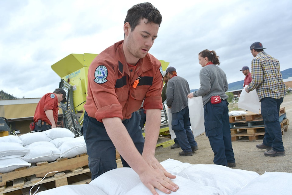
It was a story that was heard from points all along the creek, and by the time the city called a State of Emergency May 6 area residents were well into the habit of sandbagging. They weren’t necessarily ready, however, for the news to come.
City officials called a press conference May 10, announcing that Kelowna may be hit by a one-in-200 year flood.
RELATED: FOOD BANK SET BACK BY ROUGH WEATHER
“What we are expecting to see is unprecedented water levels as a result of rain, rising temperatures and melting snowpack (and) the ground is already saturated,” said Brian Reardon, CORD Emergency Operations director.
“In other words, it’s the perfect storm.”
Reardon said emergency staff were hoping for the best, but warned that those who are in the flood path would be wise to start preparing for the worst. That meant sandbagging to protect property, preparing a “go-bag” of essentials for when the evacuation order comes down and securing a place for both family and pets to find refuge. All Kelowna hotel rooms, said Reardon, are already booked.
RELATED: STUNNING VIEWS FROM FLOOD FLY-OVER
“Last week’s flooding may prove to be a dress rehearsal for a much larger event,” he warned.
When the water rose it was more slowly than anticipated, prompting criticism of city officials. That said, the damage they warned of did come, just more slowly than expected.
By the end of May, Okanagan Lake levels surpassed the mark met in a previously record breaking 1997 flood, leaving lake adjacent home owners to start doing the heavy sandbagging.
Beaches were closed and tourism operators who utilized the lake struggled to start up in time for the season.
Boating was not recommended, as flooding pushed trees, branches and other debris into the lake, creating a hazard for boaters. There was also concern about waves further damaging lakefront homes.
RELATED: ANXIETY FLOWS WITH FLOODS
All around the lake, water infrastructure also took a beating. Docks were peeled back at all beaches and even today the reconstruction efforts have barely made a dent. Tourism operators and downtown businesses have often lamented the impact.
It was a remarkable season and it changed the way some political bodies are conducting themselves.
Kelowna council is one of many set to take a closer look at how to mitigate the effects of climate change.
A Community Trends report looked at the extreme weather that threw the city into chaos and offered some suggestions on what should be offered going forward.
“By understanding how climate change is impacting our community, it is possible to understand how the city and community should respond to this emerging issue to complement the city’s efforts on climate action,” said Ross Soward, planner specialist.
“Through the four lenses of Our Environment, Our People/Health, Our Economy and Our Infrastructure, this year’s Community Trends Report looks at these extreme weather events, using the best available information, to help us understand what we can expect in the years to come and what we might be able to do to prepare.”