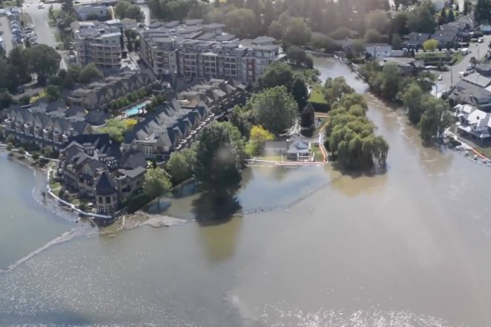
Property owners along the waterfront prone to flooding or to damage due to flooding are encouraged to install protective measures for lake levels that could reach 2017 levels.
Property owners are responsible for the protection of their property, docks and marine infrastructure, according to the Central Okanagan Emergency Operations centre in a news release.
Sand and sandbags locations throughout the Central Okanagan are available at www.cordemergency.ca/map.
Protection of public infrastructure
Central Okanagan Emergency Officials are receiving assistance from Canadian Forces personnel and B.C. Wildfire Services crews and contractors to protect key public infrastructure in low lying areas.
Flood prevention measures will continue to be deployed by the emergency operations centre officials based on risk to local infrastructure and public safety.
The public is asked to keep clear of the installations for their own safety and to ensure the continued protection of community infrastructure and property, the release said.
Emergency officials continue to conduct advance planning and prepare models for possible lake effect flooding, should Okanagan Lake rise to 2017 levels.
Boating and debris
Boaters are encouraged to keep wakes levels low to minimize wave action along the waterfront to reduce the risk of erosion and damage to docks and other foreshore infrastructure. Debris washed up on beaches should be left for the time being, as logs and other wood material can help to limit erosion caused by wave action.
Staying safe around high waters
As May long weekend arrives, residents and visitors are encouraged to keep clear of fast-running creeks and streams and stay away from eroded banks. Stay alert for changing conditions and check local municipal websites for information related to recreational access to path and trails, the release said.
More information
For a visual representation of lake levels today and historical levels, check out the graphic at www.cordemergency.ca/beprepared/flood-faq.
For information, including active evacuation alerts and orders across the Central Okanagan, as well as flood-preparedness resources, visit cordemergency.ca.
edit@kelownacapnews.com
Like us on Facebook and follow us on Twitter.