Across the Central Okanagan, city crews are working overtime to build up creek banks, organize sandbags and clear waterways in preparation for potential floods.
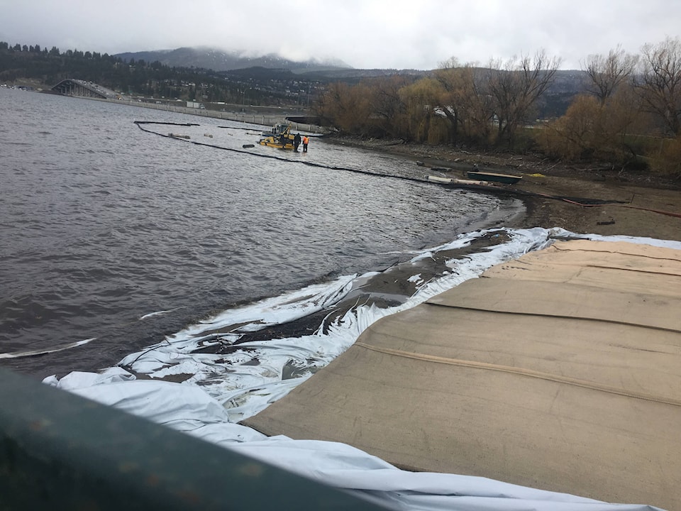
One of the more noticeable efforts is a City of Kelowna project aimed at deepening Mill Creek, allowing it to more efficiently hold water when the snow on area hillsides inevitably melts.
“We’re dredging at the bottom of the creek,” said Alan Newcombe, the City of Kelowna’s director of infrastructure.
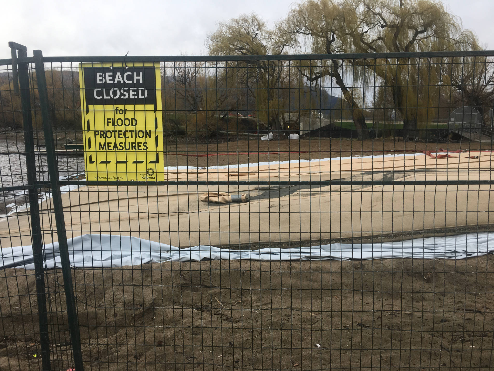
Newcombe explained that the big sheets that are sitting on the beach near the WR Bennett bridge are part of the filtration system.
“Those are geo-tubes. We have a vacuum pump machine near the mouth of the creek and it sucks off the bottom sand and debris and it goes into these tubes,” he said, adding that they allow the water to go back into the lake and the silt stays behind.
READ MORE: FLOODS START ALREADY
They’ve also pulled a couple of shopping carts and bikes from the creek with the dredging effort — though they don’t actually go through the vacuum.
There could be more interesting discoveries in the days ahead.
“It’s been a long time since we’ve done anything like this … we haven’t been able to for some time,” said Newcombe.
Permissions from the Ministry of Environment are required for this kind of work and they haven’t been granted in decades.
“What changed was last year we had a significant flood event and it was realized that one of the contributors was a lack of channel capacity,” said Newcombe.
Mill Creek isn’t the only area where flood mitigation measures are being taken as water levels noticeably rise. The Regional District of the Central Okanagan sent out a press release Tuesday assuring area residents that there are no imminent threats of flooding in the Central Okanagan electoral areas.
An isolated overland flooding issue in the Valley of the Sun subdivision that flooded in the past is being monitored. Depending on the weather, the risk of above average creek levels and potential flooding could rise given the higher than average snowpack at the mid and upper elevations, the news release said.
Those living near creeks, streams and low-lying properties that have had flooding issues in the past are reminded that they are responsible for having an emergency plan as well as the tools and equipment necessary to protect their properties from possible flood damage, the release said.
They should monitor water levels and prepare their properties if they have concerns to reduce the risk of damage from potential flooding. You may want to inspect your properties and adjacent culverts/drainage and clear debris to ensure that they will not impede water flow or redirect water to cause flooding on other properties. Before doing any work in and around water courses or sensitive areas within the electoral areas, check with FrontCounter BC, as you may require special authorization or permits.
Sand and sandbags are available for residents who wish to prepare at four RDCO firehalls:
· Ellison Station 61 – 4411 Old Vernon Road
· North Westside Short’s Creek fire hall Station 102 7355 Westside Road North
· Joe Rich Station 51 - 11481 Highway 33 East
· Wilson’s Landing Station 42 – 2396 Westside Road North