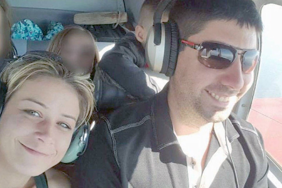
Fog and snow were factors in a fatal plane crash that killed an Alberta couple when their plane went down in Glacier National Park near Revelstoke on Nov. 25, 2017.
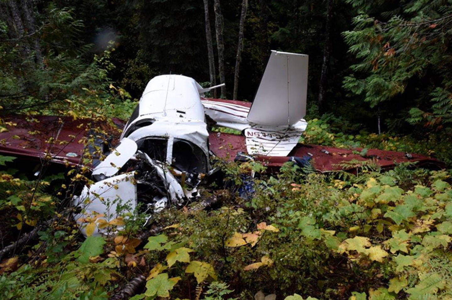
| A photo of the plane crash that killed Ashley Bourgeault and Dominic Neron Nov. 25, 2017, The photo was included in the Air Transportation Safety Investigation report. (RCMP photo) |
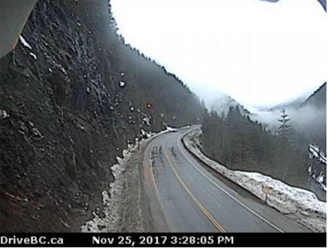
A limited-scope Air Transportation Safety Investigation report released Wednesday used DriveBC webcam photos to show that at the altitude the plane was last recorded, there was limited visibility including low ceilings, fog and snow at the time of the crash in the area where the single-engine Mooney M20D aircraft went down.
| A DriveBC webcam photo of the conditions the day of the crash. (screengrab) |
The report states the geographical area forecast for the Glacier National Park and Rogers Pass area called for intermittent ceilings with mist and light rain and a visibility five and six miles. Visibility of at least three miles is needed under visual flight rules.
The report states Neron took off from Penticton airport at 2:22 p.m. then headed towards Revelstoke airport. At about 3:10 p.m., while over Revelstoke airport, the plane circled four times descending to about 4,200 feet. Neron then flew the plane along the Trans-Canada Highway, heading east towards Rogers Pass. At about 3:27 p.m. the plane passed the Jack McDonald Snowshed at 5,200 feet travelling 131 knots. The last two GPS track points recorded before the crash show the plane was in a steep incline climbing 840 feet in 11 seconds.
The plane with the remains of Neron and Bourgeault was found about 500 feet north of the Trans-Canada Highway in a heavily forested area, 3,500 feet above sea level.
“Examination of the wreckage indicated that the aircraft struck the terrain in a steep, nose-down attitude,” the report stated.
The landing gear was partially out, but investigators were unable to determine if it was because Neron deployed the gear or if came out on impact.
READ MORE: Plane missing since Nov. 2017 located in Glacier National Park
READ MORE: Plane search unveils unrelated plane crash site from 1987
READ MORE: Search for missing plane in Revelstoke area
The engine was working at the time of the crash. Investigators found an existing malfunction with a component in the plane’s engine that distributes power to the spark plugs, but the report notes “the condition would have resulted in a minor reduction in engine performance.”
The Emergency Locator Transmitter (ELT) was found at the crash site. On impact the antenna was broken and the batteries ejected. When batteries were put inside the transmitter started working again, the report stated.
The report outlined several safety messages including that current ELT system design standards do not include a requirement for a crashworthy antenna system, and, “flying in deteriorating weather conditions is challenging; the associated risks need to be managed properly before and during flight, especially when flying over mountainous terrain.”
To report a typo, email:
editor@keremeosreview.com.
@TaraBowieBC
editor@keremeosreview.com
Like us on Facebook and follow us on Twitter.