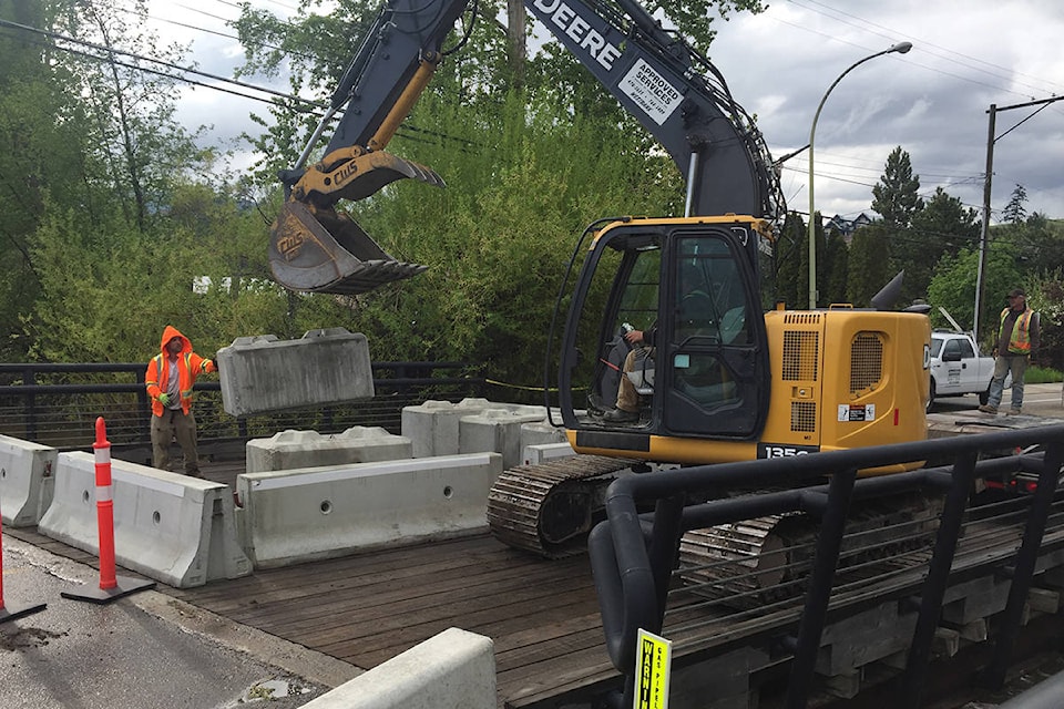
West Kelowna crews moved to fortify a key bridge in the city Wednesday, as fast-moving creek water flowing beneath it continued to rise.
With the Gellatly Road Bridge over Powers Creek threatened, large concrete blocks were placed on it to keep the bridge from being ripped from its moorings by the rising creek water.
Because of a closure of another part of Gellatly Road to the north, the section of Gellatly running alongside Okanagan Lake where the bridge is located can now only be accessed from Boucherie Road via a Carrall and Witt Road detour. The section of Gellatly to the south, from the bridge the Cove Resort,canbe accessed from the Glenrosa Road overpass off Highway 97.
The bridge itself is closed to traffic and the portion of the road to the south, between the Kelowna Yacht Club and the Cove resort is heavily sandbagged and only open to local traffic.
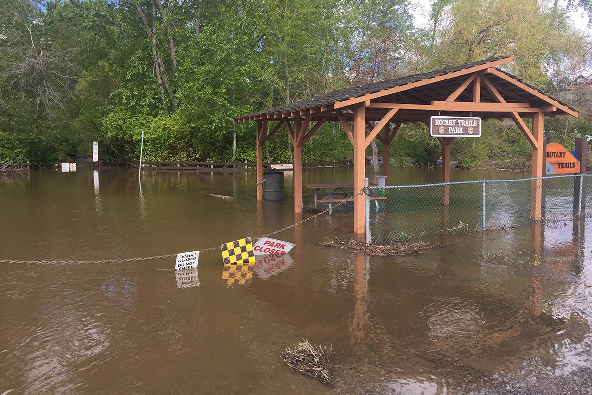
Nearby Rotary Trails Park, which sits alongside Powers Creek, is closed because it is totally submerged by creek water.
On Wednesday evening, a sign at the now closed Gellatly Bay boat launch across the street from the bridge showed Okanagan Lake an inch below full pool. But by Thursday morning, the lake level had risen to above the full-pool marker.
The flooding has also closed a stretch of Gellatly Road to the north, between Witt Road and Angus Drive, because Smith Creek, which runs parallel to that section of Gellatly, has eroded the banks of the road.
Motorists are being detoured using Carrall and Witt Roads and are being asked to respect the 30-kilometre-per-hour speed limit in place on Carrall and Witt Roads, or to choose alternate roads to get to and from Highway 97.
Large truck traffic should avoid the Carrall and Witt Roads detour route, says the city.
Another road closure in West Kelowna is a portion of Shannon Lake Road from east of Shannon View Drive to the intersection with Stevens and Bartley Roads. Creek water there has also threatened a bridge.
Motorists can use Shannon Ridge Drive to access Highway 97 but are asked to respect the 30 km/h speed limit in place through the residential area, or preferably, access Highway 97 through Westbank Centre instead.
The city says it had scheduled reconstruction of the Shannon Lake Bridge for this summer and had worked with Westbank First Nation on the timing of the work in relation to the WFN’s planned sidewalk construction on Old Okanagan Highway, which is currently underway.
The plan was to keep alternate routes open for detoured Shannon Lake Road traffic but, according to city hall, Shannon Ridge Drive is now taking the brunt of detoured traffic.
The city and the Westbank First Nation say with their respective residents preparing to protect their properties from rising creek and lake waters, sand and sandbags can still be be found at the following locations:
• In Green Bay at 1341 Green Bay Road, Osprey Park and at the Wiig Road cul-de-sac
• 2606 and 2714 Casa Loma Road
• 1651 Pritchard Drive
• 4081 Hitchner Road
• 2589 Whitworth Road (Pebble Beach Park)
• Across from the WFN Works and Utilities yard at the intersection of Cougar Road and Elk Road (approximate address 3500 Red Cloud Way)
• 515 Highway 97 South (WFN Government Building) to the right of the main parking lot.