UPDATE: 7:30 p.m.
The McDougall Creek wildfire is now an estimated 11,000 hectares in size.
BC Wildfire updated the approximate size of the blaze in West Kelowna at about 7:20 p.m. Saturday.
“Visibility has been challenging and limited our ability to get an updated aerial track at this time. Direct response for protection and defence of properties and critical infrastructure is the priority at this time,” stated BC Wildfire.
There will be 60 personnel are working over night and there were 119 personnel on scene today.
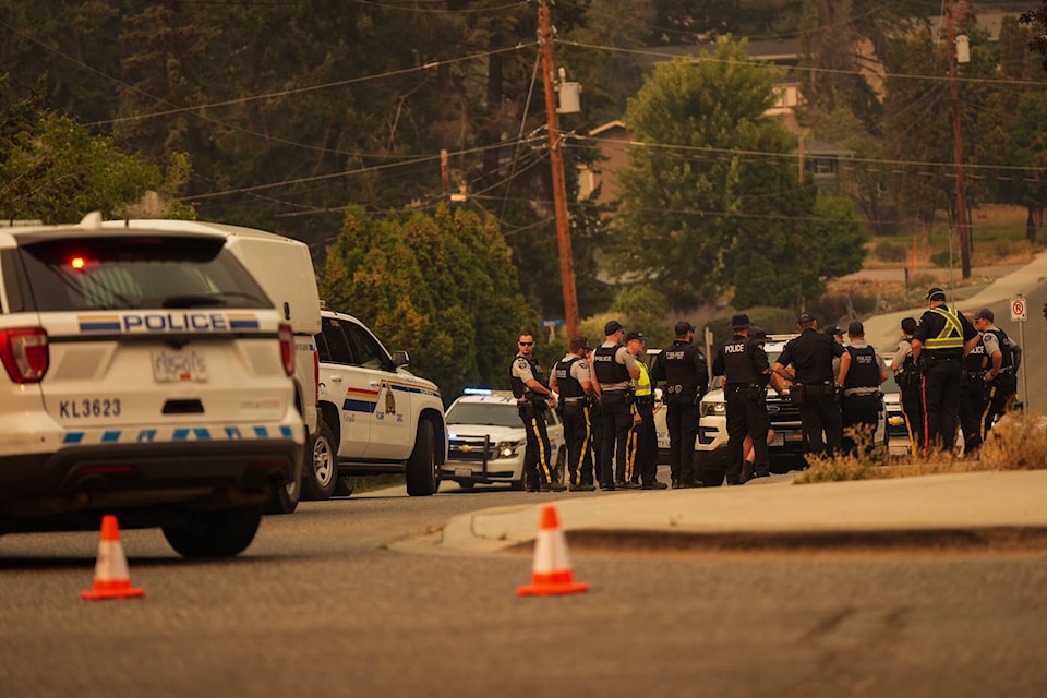
Structure protection personnel, engines and water tenders from communities across the province have been arriving throughout the day.
The McDougall Creek wildfire is now part of the Grouse Complex. The Grouse Complex consists of three wildfires, McDougall Creek wildfire in West Kelowna, Walroy Lake wildfire in Kelowna and Clarke Creek wildfire in Lake Country.
UPDATE 10:30 a.m.
Fire activity at the McDougall Creek wildfire has calmed down throughout Saturday morning.
In BC Wildfire latest update, the blaze has been at a rank 2 and 3 this morning, which is a low to moderate level.
Wildfire service and the West Kelowna Fire Department continue to battle the fire and have support from the Regional District of Central Okanagan (RDCO) and surrounding communities.
Heavy machinery will also be used today to battle as blaze as well as structure protection crews. Helicopters have also been back in action watering down the fire.
“Direct response for protection and defense of properties and critical infrastructure is the priority at this time,” says BC Wildfire Services.
The fire remains at 10,500 hectares as visibility is making it challenging for crews is estimate the fire’s size.
BC Wildfire Services and Transport Canada would like to remind the public that using drones in the area of a wildfire is illegal.
@kelownacapnews Aug. 19, morning update for Central Okanagan Wildfires. #kelowna #westkelowna #mcdougall #okanagan #britishcolombia ♬ original sound - Kelowna Capital News
Original
The McDougall Creek wildfire continues to cause chaos in West Kelowna.
As both the City of West Kelowna and the province are in a state of emergency, most of West Kelowna and up Westside Road to Fintry remain under evacuation order, meaning residents must leave their homes.
The latest stretch of evacuations was announced by the Central Okanagan Emergency Operations just before midnight on Friday, Aug. 18.
Properties located between Fintry Park and Highway 97, the Smith Creek neighbourhoods and parts of Shannon Lake were put on evacuation orders and must leave their properties immediately.
Residents in the West Kelowna Business Park, the Smith Creek agricultural area, Shannon Lake, Glen Canyon and North Glenrosa are now on evacuation alert and should be prepared to leave at a moment’s notice.
The evacuation map can be viewed on the Central Okanagan Emergency Services website.
Multiple structures were lost on Friday, including Lake Okanagan Resort, located north of Wilson’s Landing on Westside Road. The exact number of structures is unknown at this time.
As of 7 a.m. Saturday (Aug. 19), the McDougall Creek wildfire remains at an estimated 10,500 hectares and out of control. It is one of 16 wildfires of note across the province.
Black Press Media will keep up to date throughout the day.
READ MORE: OKANAGAN WILDFIRES: What you need to know for Saturday, Aug. 19
LIST OF EVACUATIONS ISSUED FRIDAY:
11:45 p.m.:
Properties located between Fintry Park and Highway 97, the Smith Creek neighbourhoods and parts of Shannon Lake are now on evacuation orders and must leave their properties immediately.
The residents in the West Kelowna Business Park, the Smith Creek agricultural area, Shannon Lake, Glen Canyon and North Glenrosa are now on evacuation alert and should be prepared to leave at a moments notice.
Areas of North Glenrosa that are specifically within the evacuation alert area are:
- BLUE JAY DR
- CANARY DR
- CARRE RD (CARRE RD NORTH OF GLENROSA RD)
- CHELSEA CRT
- CORINE RD
- CORRAL CRT
- COVENTRY CRES
- GATES CRT
- GATES RD (GATES RD NORTH OF GLENROSA RD)
- GLENROSA RD (3280-3770)
- MCBAIN RD
- MCCOY RD
- MCGEE CRT
- MCGINNIS RD
- MCGREGOR RD
- MCIVER RD (MCIVER RD NORTH OF MCRAE RD)
- MCLEOD RD
- MCMAHON RD
- MCMORLAND RD
- MCMURCHIE RD
- MCNAIR RD
- MCNALLY RD
- MCPHERSON RD
- MCQUEEN RD (even numbers from 3388-3310)
- MCRAE RD (even numbers from 2912-2996)
- MCROBBIE RD
- ORIOLE DR
- PRESTON RD (PRESTON RD NORTH OF GLENROSA RD)
- REGENT RD
- ROSEDALE CRT
- ROSEDALE PL
- SALMON RD
- STONEGATE CRT
- TARRAGON CRT
- WEBBER RD (WEBBER ROAD NORTH OF MCRAE RD)
9:42 p.m.:
The City of West Kelowna is issuing an evacuation evacuation order for the Smith Creek subdivision. This excludes 3184 Shetler Drive.
8:40 p.m.:
Properties on Westbank First Nation IR#9 have been placed on evacuation order, including: All properties located on Westbank First Nation IR#9 North of Highway 97 between Daimler Drive and Grizzly Road and all properties located on Westbank First Nation IR#9 North of Old Okanagan Highway between Grizzly Road and Shannon Lake Road
Specific additions include: 3206, 3210, 3230, 3270 Shannon Lake Road.
7:20 p.m.:
Residents living in Boucherie Industrial area to Smith Creek, the Tallus Ridge and Shannon Lake neighbourhood, IR09 North of 97 to Old Okanagan as well Rose Valley and West Kelowna Estates.
5:49 p.m.:
The following properties in the City of West Kelowna’s Casa Loma neighbourhood have been placed on evacuation alert:
- ALICE RD
- BENEDICK RD
- CAMPBELL RD
- CASA GRANDE DR
- CASA LOMA RD
- CASA PALMERO DR
- CASA RIO DR
- LUCINDE RD
- ZDRALEK COVE
5:43 p.m.:
The following properties on Westbank First Nation IR#10 have been placed on evacuation alert:
- ABEL PL
- ESSEN RD
- ABEL ST
- HIGHWAY 97
- ALEXANDER PL
- HIGHWAY 97 S
- BAYVIEW CRT
- MANUEL RD
- CAMPBELL PL
- MICHELLE CRES
- CAMPBELL RD
- SNEENA RD
- DERRICKSON PL
- TOMAT AVE
5:20 p.m.:
An evacuation alert is being issued from Nahun to Killeney Beach.
The area is right outside the Fintry Province Park where an evacuation order is in effect.
4:45 p.m.:
Properties on Westbank First Nation IR#10 have been placed on evacuation order.
The order includes the following properties:
- BEACH VIEW LANE
- LINDLEY DR
- BEAR CREEK RD
- LINDLEY RD
- BROOKSIDE PL
- MARINA WAY
- CAWSTON AVE
- MARINA WAY E
- CREST RIDGE LANE
- NANCEE WAY
- FERRY WHARF RD
- NANCEE WAY CRT
- HARBOUR GREEN RD
- OKANAGAN LAKE
- HARBOUR POINTE LANE
- OLD FERRY WHARF RD
- HARBOUR VIEW BLVD
- ROSIE DR
- HARBOUR VIEW CRES
- SOOKINCHUTE CRT
- HIGHWAY 97
- SPLAND RD
- HIGHWAY 97 S
- VIEWPOINT CRES
- HIGHWAY 97 S
- VIEWPOINT DR
- HORIZON DR
- WATERS EDGE LANE
- KATHERINE RD
- WESTSIDE RD
- LAKE BREEZE RD
- WESTSIDE RD S
- LAKE VISTA DR
- LAKE VISTA RD
1:49 p.m.:
Properties north of Terrace Mountain Road along Westside including La Casa up to and including Fintry Provincial Park must evacuate north on Westside Road.
Properties include:
- BARCELONA DR E
- DELTA RD
- DUNWATERS RD
- FAIRBRIDGE RD
- FINTRY DELTA RD
- FINTRY ESTATES
- GRAY RD
- KELLY PL
- LA PALMA LOOP
- MADRID WAY
- MARBELLA LOOP
- MORDEN RD
- MUIR RD
- SANTE FE WAY
- SANTIAGO LOOP
- SHALAL RD
- SHORTS RD
- SHORTS CREEK
- TERAZONA DR
- TOLEDO DR
- VALENCIA WAY
- VERONA LOOP
- WESTSIDE RD
- WESTSIDE RD N
8:55 a.m.:
Properties north of Nahun to, but not including, La Casa are now under evacuation Order due to the McDougall Creek wildfire in West Kelowna.
@cunninghamjordy
jordy.cunningham@kelownacapnews.com
Like us on Facebook and follow us on Twitter and subscribe to our daily and subscribe to our daily newsletter.