UPDATE 4 p.m.
More Central Okanagan residents are getting the OK to go home.
Electoral Area West from La Casa south to 4017 Westside Road is no longer on evacuation order, but an alert remains in place.
Residents will have to access Westside Road from Highway 97 in Vernon.
Drivers are asked to be patient and mindful of speed.
The Emergency Support Services reception centre is moving to 523-3041 Louie Drive in Westbank. The centre will be open Sept. 1 from 9 a.m. to 4 p.m. Over the long weekend hours will be from 10 a.m. to 2 p.m.
UPDATE 9:30 a.m.
Rain throughout the night for the second straight evening helped crews at the McDougall Creek wildfire in West Kelowna.
Overnight, the fire received anywhere from 3-5 millimetres of rain. The cooler temperatures and cloud cover is expected to continue to help the blaze throughout the day on Thursday.
Over the last three days, BC Wildfire Services has extinguished all existing hot spots adjacent to properties along Westside Road. In the process, infrared scans were completed to ensure all hot spots were taken care of. Crews on Westside Road are demobilizing non-essential equipment on Thursday.
A 700-hectare growth of the wildfire took place towards the Power Creek drainage area over the last two days because of increased fire activity due to winds gusting up to 40 km/h.
On Wednesday, 250 structure protection personnel arrived and completed a defense plan for the Glenrosa community. This personnel are at the ready in case fire activity increases and moves toward the neighbourhood.
Crews are continuing to extinguish hot spots to 100 feet inside the fire perimeter behind structures on West Kelowna Road, Pettman Road and Westlake Road.
On the southwest flank of the fire, crews are working to reconstruct a safe access and exit route for ground personnel. In the area, there is just one route into challenging, and in some spots, inoperable terrain. Heavy equipment is working along Smith Creek Road to help create safer routes. Rappel crews are also going to be constructing helipads north of Powers Creek Drainage.
On Friday, Aug. 25, BC Wildfire Services implemented an area restriction order which remains in effect until Sept. 8 or under rescinded. This order is in place for public safety because of the following hazards:
- Heavy equipment and chainsaw operators: Heavy equipment and chainsaw operators can’t hear or see you when operating equipment.
- Ash pits: Deep, intensely burning stumps and tree roots may result in hot ashpits underground that can lead to severe burns if you step or fall into one.
- Falling trees: Drought and burnt-out tree roots cause unstable trees that may fall at any time, especially if it’s windy.
At this time, it is estimated 487 properties are under evacuation order, while 20,029 properties are under evacuation alert. Of the properties on evacuation order, 307 are within RDCO Electoral Area West, 142 are in the City of West Kelowna, and 38 are within Westbank First Nation.
Original
The McDougall Creek wildfire grew on Aug. 30 but some evacuation alerts were rescinded in the process.
On Wednesday night, evacuation alerts were rescinded by Central Okanagan Emergency Operations for the following properties:
- Properties from IR9 Old Okanagan Highway to Highway 97 and IR10 South of Highway 97;
- AUBURN RD (only includes properties on the east side);
- BARTLEY CRT;
- BARTLEY RD (only includes 2550, 2570);
- BYLAND RD;
- COMPASS CRT;
- DAIMLER DR (only includes 2010);
- DOMINION RD (only includes 2322, 2339, 2343, 2352, 2363, 2364, 2373, 2382, 2386, 2387, 2392, 2405, 2412, 2421, 2431, 2441);
- INDUSTRIAL RD;
- JULIANN RD;
- KYLE CRT;
- KYLE RD;
- ROSS RD;
- SHANNON LAKE RD (only includes 1775);
- STEVENS RD (only includes 1115, 1135, 1279, 1285, 1295, 1322, 1340, 1341, 1360, 1369, 1385, 1395, 1405, 1425, 1435, 1445, 1450, 1501, 1516, 1520, 1540, 1565, 1570, 1580, 1655, 1689);
- WESTERN RD.
On Aug. 29 West Kelowna council extended the state of local emergency until Sep. 7. It was set to expire Aug. 31.
In BC Wildfire Services last update just before 9 p.m. on Wednesday night, new mapping grew the size of the blaze of 13,712.3 hectares.
Wednesday night into Thursday morning has continued to be cold and wet, helping fire crews battle the blaze. It remains out of control and a wildfire of note.
More showers are expected Thursday morning with 20 km/h winds in the afternoon and a high of 19 C.
Transport Canada and the BC Wildfire Service prohibit the use of drones of any size near a wildfire. The operation of any aircraft not associated with fire suppression activities within a radius of five nautical miles around a fire, including unmanned aerial vehicles (UAVs or drones), is illegal. Anyone found interfering with wildfire control efforts may face penalties up to $100,000 and or up to one year in jail.
Black Press Media will keep updated throughout the day.
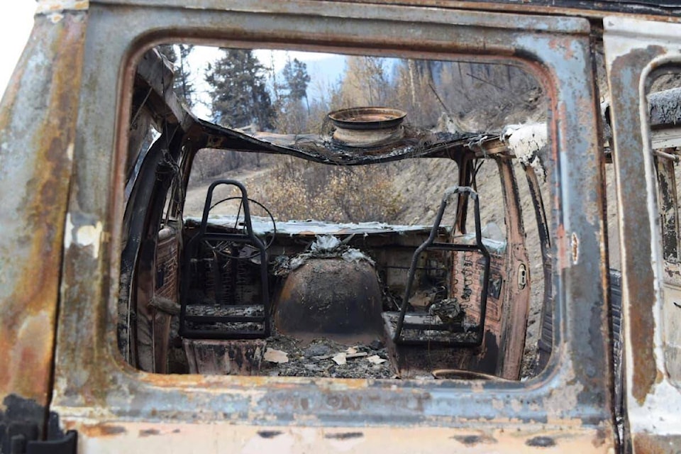
READ MORE: ‘Nothing left’: West Kelowna resident reveals shocking wildfire damage
READ MORE: Rockslide near Summerland closes Highway 97 for Labour Day long weekend
@cunninghamjordy
jordy.cunningham@kelownacapnews.com
Like us on Facebook and follow us on Twitter and subscribe to our daily and subscribe to our daily newsletter.