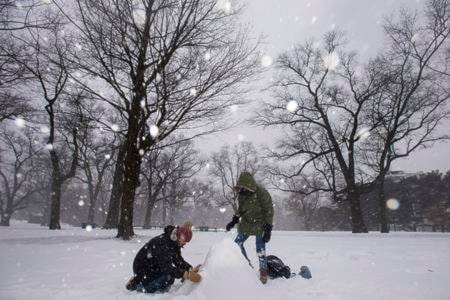
A massive winter storm moving northeast from the United States pelted Ontario with snow, ice and high winds on Tuesday, with Canada’s weather agency warning residents to brace for worsening weather before the system moved east into Quebec.
Environment Canada issued widespread winter storm warnings across Ontario as a Colorado Low made its way into the province, promising everything from freezing rain in the southwestern part of the province to as much as 40 centimetres of snow near the Ottawa region.
READ MORE: Second snow warning calls for 15-25 centimetres for B.C.’s south coast
Schools and post-secondary institutions across the province called off classes and airlines cancelled flights by the dozens.
The closures in Ontario may be a sign of things to come for the rest of the country, said Environment Canada meteorologist Gerald Cheng, adding the system promises to make itself felt in Quebec and all points east in the coming days.
“It’s not just affecting parts of Ontario, it’s also affecting Quebec and eventually all the Atlantic provinces,” he said in a telephone interview. “Basically, a lot of people in eastern Canada will be affected by this storm.”
Cheng said moisture the storm system will have gathered on its way north will result in freezing rain falling on a large stretch of southwestern Ontario from Windsor to London. As it moves north, however, Cheng said the precipitation will shift to a combination of snow and ice pellets.
That mix is expected to fall on the Greater Toronto Area and surrounding regions, he said, bringing between 15 and 25 centimetres of combined precipitation.
Snowfall totals are expected to rise as the storm travels east, he said, adding the Ottawa area can brace for as much as 40 centimetres.
The storm is expected to hit Quebec overnight and into Wednesday morning, he added.
”This is a big storm, and not only are we talking about the precipitation … winds can gust up to 80 kilometres per hour,” he said, adding such high speeds increase the risk of downed power lines and damage from toppled trees.
As the storm escalated early Tuesday morning, closures and cancellations piled up across the province.
The Toronto District School Board was among many that cancelled all classes and bus routes for the day, an unusual move for an organization that said it had not implemented across-the-board closures since 2011. Ryerson and York Universities closed for the day, and two out of the University of Toronto’s three campuses also suspended classes.
Arrival and departure boards at Toronto airports were clogged with cancellations and delays, particularly at Billy Bishop airport in the city’s downtown where wind gusts were registered at more than 70 kilometres per hour.
Michelle McQuigge , The Canadian Press