The White Rock Lake wildfire near Westwold is now burning out of control across 24,000 hectares.
BC Wildfire Service (BCWS) provided the size estimate in an update at 7:23 p.m. on July 31.
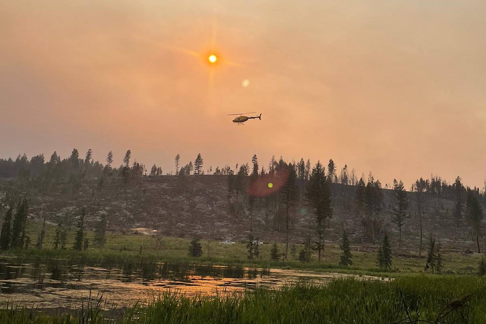
Conditions on scene are extremely smoky, making it hard for aircraft to fly and challenging suppression efforts, said BCWS.
The heavy smoke is also impacting hydro lines. Power outages have occurred and may continue to do so.
Read more: Smoke from fire near Westwold affecting hydro lines: BC Wildfire Services
Fire growth is expected to continue the east and northeast and crews are continuing to work under extremely adverse conditions.
Six of the 50 structure protection personnel at the scene of the fire will remain there overnight to provide structure protection continuity, said BCWS. They will continue to assess and prioritize critical infrastructure and properties, working from Monte Lake towards the Falkland Corridor via Highway 97.
117 firefighters, 12 support staff, 38 pieces of heavy equipment, nine danger tree assessors/fallers, eight helicopters and an incident management team are assigned to the fire.
All evacuation orders and alerts issued due to the wildfire are still in effect.
The fire has 20 properties in the Regional District of North Okanagan on evacuation order, along with 85 from the Thompson-Nicola Regional District and one seasonal resort, eight seasonal dwellings, one seasonal property and two year-round residences within the Columbia-Shuswap Regional District.
Another estimated 1,220 properties across the three districts are on alert, ready to move at a moment’s notice.
An evacuation alert is also in effect for a portion of Okanagan Indian Band IR#1, from the southernmost boundary to Newport Beach, including Old Mill site, Parkers Cover, Whiteman’s Creek, 6 Mile and Komasket Park Area.
Read more: Two Mile wildfire fight going well despite tough terrain, smoke: Sicamous fire chief
@roman_reports
zachary.roman@saobserver.net
Like us on Facebook, follow us on Twitter and subscribe to our daily newsletter.